ArcGIS Mapping
The Dallas-Fort Worth Hospital Council Foundation (DFWHC Foundation) has purchased ESRI ArcGIS software to assist with the geographical coding of data from our information warehouse. This software has the ability to translate addresses to points on a local map. It can be used to place data layers across the map in order to see relationships between the environment and the cases of disease. It also has the power to track patients traveling from one hospital to another.
The mapping of data allows viewers to see community numbers at a glance without overall statistics. The DFWHC Foundation is preparing to add a mapping tool to the data warehouse, allowing us to query and map simultaneously.
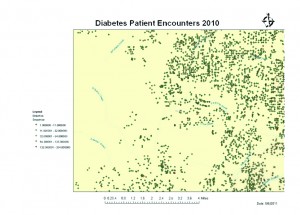
The DFWHC Foundation will have staff members trained in geographical mapping data throughout the summer. This map displays the number of visits to a hospital when patients had a primary diagnosis of diabetes. For more information, please feel free to contact me at pdoughty@dfwhcfoundation.org.

